Originally published in about 2015
Bralorne is a well-known area that rolls off the tongue for any knowledgeable explorer of BC backroads; it’s a must-see destination. However, people rarely mention the hidden gems just beyond the outskirts. It was May Long Weekend, and I had a dream destination on my list for years.
I left the Lower Mainland Saturday morning heading up the 180 kilometres of the beautiful West Harrison FSR; this route provides you with a great beginner off-road exploration opportunity. Nothing too challenging; however, it will leave you breathless with mixed scenery: mesmerizing waterfalls, hidden coves along the lake you can find by exploring the trails, and the vast beauty of the mountains embracing the waters. After a leisurely drive and a few hundred pictures, I neared the Pemberton area as the sun began to set.
The Hurley wasn’t open for the season yet, so I found a quiet camping spot a bit off the main road. The next morning, I enjoyed the sights as I headed over one of my favourite paved scenic routes: Duffy Road to Lillooet. After gassing up in Lillooet, I headed up to the Horseshoe Canyon, stopping to grab a few geocaches along the way.
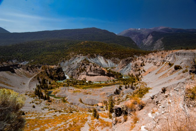
The Horseshoe Canyon is one of the 7 wonders of BC; nothing is more calming than sitting there on the edge of the precipice, looking down at the sandy cliffs that hold you up, and gazing over at the walls of the canyon surrounding you. It is a beautiful sight; however, take a moment to consider the power that created it and the forces of nature that merged to form that unique curve. With visible layers showing the passage of time, it’s like stepping through a portal that shows BC’s geological past in a single glimpse.
The primary road from Lillooet to Bralorne is interesting, offering extreme beauty in its barely patched-together form. It offers that unique half-pavement, half-off-road experience where you can see the ravages of the past forest fires, the culture of the Indigenous people who still live in the area, with the option to take off and explore the many tougher side roads and offshoots that will lead you to amazing vistas with a little bit of low-range use.
I continued on, crossing into the Carpenter Lake Area and passing by other beautiful locations I had visited earlier: the Yalokum Valley, Shulaps, and the abandoned Jade mine hidden in the hills to my right. Along the Carpenter Lake road, you can visit historic sites left behind by the dam’s flooding. Minto Mine is one of them; it’s easy to find from the well-marked campsite on what used to be the town of Minto. I don’t recommend exploring abandoned mines for safety reasons; however, I couldn’t resist grabbing a headlamp and taking a chance.
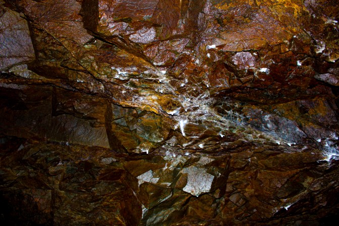
I wasn’t prepared for a mine exploration and didn’t have proper footwear; luckily, for the first few hundred feet, that wasn’t an issue. I managed to skirt the rather large puddles along the way. The growths on the ceilings and walls were mesmerizing; the colours that I could see through the headlamp were beautiful shades of red and pearlescent white. Remnants of the mine still showed in the little signs hanging along the walls, the metal spikes, and the wires running along the ceilings. I turned a corner, and you could see the wooden structures that remained from eons past. Several chutes branched off, along with a larger central room with a large hole in the middle and what looked like drop-in zones for carts and hauling out ore.
I closed my eyes for a moment, standing there, and could hear the men who had worked this decades earlier bustling about. I could hear their laughs as they got through the day, their frustrated grumbles when things didn’t work right, and feel their pain as carts slammed fingers. It was time to go; I caught a whiff of air that didn’t smell quite right, and I knew I’d return another day to explore more.
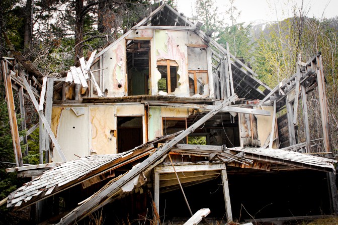
Next up was Goldbridge and Bralorne, as I crossed the bridge into town, this giggle overcame me, I was there, I was really at my must see location for the year! When you first come into town, a little side road on the right leads to the magical Will Haylmore Heritage site. You can wander the grounds, step into the buildings, and see the pieces of machinery still scattered around. It’s a great introduction to what you can expect as you head further into town and outlying areas; it has survived incredibly well.
On your way, you’ll pass by “The Model Bakery”, which put out 6,000 loaves per week at one time. This will be followed by the few businesses that remain running and the abandoned cars that will bring a smile to your face. Then, like an episode of The Twilight Zone where time has stopped, you’ll see rows of neat, tidy houses that have stood vacant for years, fighting Mother Nature and, for some reason, winning so far.
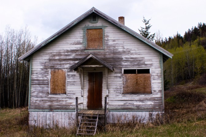
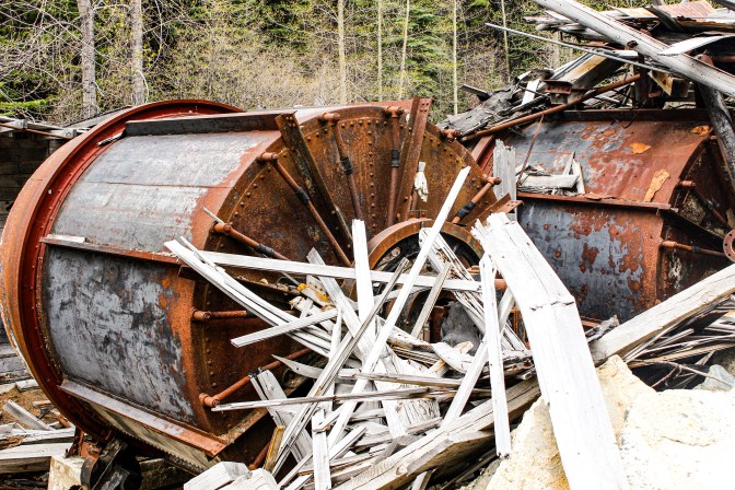
However, a short jaunt up the road brings an unexpected afternoon of adventure, exploration, and wonder. Your next stop is the Pioneer Mine and the town built for those who dedicated their lives to pulling gold from the mountain, a historic area that was one of BC’s most important gold mines for most of the 20th century. As you crest the hill, you can see the decaying structure on the hillside to the left and wonder whether it, or the hill supporting it, will give way first. To your right, a mechanical graveyard will make any photographer feel like a kid in a candy store.
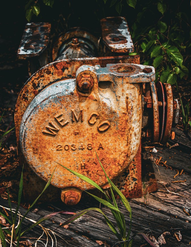
The gears, left-behind wires, and wood splintered by rusty bolts speak a language of passion, where the blood, sweat, and tears spent here still leave ghosts to speak to you as you touch the artifacts. Scattered along the roadway for a good distance, there are the remains of the other structures that supported the operations. You can stand in the dynamite room, a few root cellars, and the remains of the bridge where vehicles once crossed.
A little further up the hill (which can be accessed either by hiking up from here, or directly by road, if you go back into town and take a side route) you will find another hidden gem, you will find the homes of “Pioneer Town”. Mother Nature is starting to win the war; however, you can still find a lightbulb in a socket and, under the floor joists, the plumbing lines that brought modern conveniences to this now-desolate locale. I spent a few hours exploring the remnants of the homes, picturing what life would have been like throughout the year. The climate varied widely, from the extreme heat of summer to the harsh cold of winter. I stood amazed by how well some things were preserved, standing side by side with items so ravaged by time.
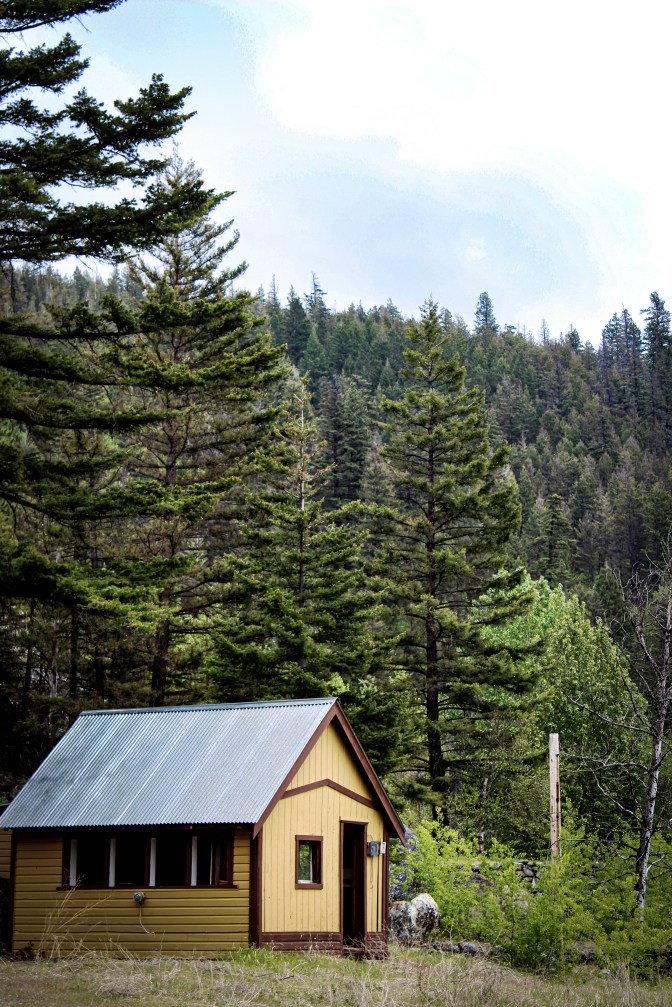
It was nearing dark, and it was time to head to the Yalokum River Recreation Site; however, I made one last stop at the house of ill repute. It really hits you when you’re standing in the archways of our ancestors’ abodes how different life was, in a way you can’t comprehend until you are surrounded by the ghosts of the past. I tried, but failed, to find the old RCMP detachment I’d heard rumours of. So many places up here still need exploring, and this area will keep me easily entertained for years to come.
As I sat around the campfire that night, I realized I’d had an epiphany while standing in front of the decaying structures. In some cases, the entire front façade had peeled away from the relics, leaving only the faded once-bright colours of yellow, green and pink. The epiphany was simple: every story deserves to be told, and it is not those who want to go down in history that are remembered. It is not the memory of the man who made the money off the mine that I am taking away with me; it is the memory of the man who built the house that will stay with me for eternity.